Many infrastructure operators, public administrations and engineers here and abroad trust the unique infra3D service and use our intelligent infra3D geo image data service for their various purposes.


ANALYZE |
VISUALIZE |
MAP |
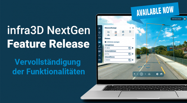
MEASURE |
and much more – just a mouse click away – without any IT expenses
infra3D Service simplifies infrastructure maintenance, the management, planning, realization and documentation of construction projects.
Many work processes, particularly structural and operational maintenance of your infrastructure systems require a wide range of spatial data. Conventional extraction of the relevant data is time-consuming, expensive and often entails risks or operational restrictions.
The infra3D service allows you to collect this data efficiently and flexibly, direct from your work place. The infra3D Service provides you with an high resolution, georeferenced 3D panorama imagery of road and rail corridors directly to your workstation or into your tablet. Using web or mobile client you will be constantly well informed about your infrastructure.
High precision & accuracy
Our infra3D image database facilitates measurement with centimeter precision (absolute und relative accuracy). Our service achieves the highest measure accuracy standards in digital surveying. These exact georeferenced online-inspections can reduce the amount of on-site inspections by 60 %.
Simplicity
infra3D is completely cloud and web based (password-protected) imagery application with an accessibility 24/7 from anywhere. The platform is very intuitive, easy to understand and work with – Measurements can be performed with the unique monoplotting (one-click) technique.
Added value through versatility
infra3D Service is flexible: sector-specific configurations allow you to adapt the service precisely to your needs. The power spectrum of infra3D covers the demand of different guarantors (public & private). The service is used in many different infrastructure applications.
Integration capacity
The infra3D Service can be integrated & combined with an existing third-party solution (GIS or CAD's). Particular geo data can be accurately displayed, overlaid and presented in its actual context through in infra3D Service.


